I was asked recently how my mapping process worked, I will concentrate on how it works with Helion and Company as most of my work is for them. Helion will approach an author or the author will make a pitch to the company, if the manuscript is viable then the legal stuff will be worked out and a contract signed. One of Helion's editors will work with the author depending on what the book is about and which period and guide him through the process.
If the book requires maps which of course most military books do if they are to be credible then the author usually provides his own, these are normally basic sketches but at times can be actual military maps of the period or such a map but anotated, Google Earth captures or even Powerpoint files anything to show the publisher what is required, permissions if required will be sought if old maps are to be updated. This is now where I come in, the editor or Duncan the managing director will contact me and ask me to look over the maps/sketches to see if there could be any problems, will the maps fit the page size, are they decipherable, are they overly complex or are they too simple, I also get the page size and whether the maps are to be black and white or colour. Once I say I can work with the information I am usually put in touch with the author and work with him from then until the final drafts are ready.
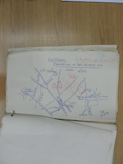 |
| Sketch |
 |
| Finished map. |
Some problems that can occur are that different maps of the same area/battle can have different spellings where the book may use modern spellings, in others roads, rivers or type can be so feint as to be useless, also very old maps when superimposed over a modern rendition can be miles out. A particular problem I always run into is the course of rivers, over a hundred years or so these can be very different to the modern course, coastlines present the same headaches. Google is not good at rivers, they are there but you have to zoom right in and if you are drawing a map of France and want all of the Loire river it is a faff to keep zooming in and out. Having said that if you have the time you can draw on Google Maps and trace the river then take a screen shot and put it over your template. Page size can also present a challenge, once I scan and fit the original sketch into the template the top or bottom, left or right hand side might be blank, to remedy this I usually look for a map of the expanded area or as a last resort go to Google and build up the missing parts. There are other tools you can use on the web apart from Google, ArcGis for instance is a geographic information website which is good for topographical information and is very good for rivers.
 |
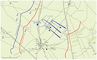
| Simple map, one of my first for Charles. |
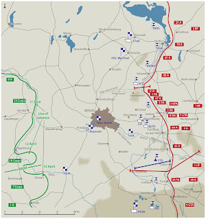
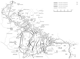 |
| Complex map. |
I use Adobe Illustrator for mapping and have a licence so the programme is kept up to date, usually several times a year and I can use it on two work stations, one in my study and one in the Post Office so I can map when on or off duty in said PO. I set up templates for the half dozen or so page sizes that most publishers use, I have also built up symbol collections for Nato military icons along with guns, wagons, aircraft, tanks, trains and German WWII unit symbols along with many others which tend to be used again and again. Lines are another thing which get used a lot, you can make basic dot/dash lines but you can also design your own i.e. barbed wire, trenches, hill slopes, rail tracks etc. Most maps are black and white, but when I have to do a map in colour I make a colour group up for the particular map and save it, there is no limit in Illustrator to colour, the tints and hues are endless, you also get colour libraries to use as well rather than make your own up.
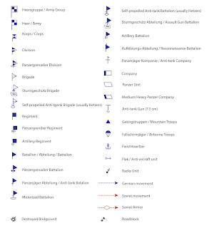 |
| German army symbols WWII |
Once I have drawn the maps I send them back to the author for input, hopefully he points out any mistakes or more likely he wants to change, add or subtract something. Some authors know exactly what they want and these are very easy to work with, others will want small changes made but only drip feed these one at a time, this does not take long but can be frustrating after going back to the map half a dozen times. I have also been lucky in that only one person among the hundreds I have drawn for made me want to throw the towel in and tell him to go elsewhere, an incredibly rude person. I have worked with professors of history, military men from generals to captains, mercenaries, amateur historians and wargamers, also many who have fought in conflicts from WWII tank gunners to South African and Rhodesian defence forces, and due to the wonders of modern science with people from Peru to Australia and all points in between. I have only ever met two of the authors in person who came to my house to ensure I knew what they wanted, dedicated and very nice chaps.
 |
| "Bloody Streets" patiently waiting for this in January. |
If the author is happy with the work I then do a final look through and convert the Illustrator files to .eps files for the typesetter, some only require high resolution .jpg's so I normally send both to the editor who then passes them to the typesetter. My job then is done.
I do not get copies of the books which contain my maps, which is fine as many may only have half a dozen or less in them and I do not have the room to store them if I did, also many are simply not what I am interested in. I was kindly given a copy of the WWII Eastern Front Atlas I drew. I do tend to buy books which have a lot of maps in or which I think special, I am looking forward to getting my copy of "Bloody Streets: Battle for Berlin" which I am told will have a separate map booklet much like "The Combat History of the 21st Panzer Division" which is now a collectors item, the hardback that is. Helion also acknowledge that it was me who drew the maps in their books, many publishers do not mention the cartographer at all, many authors whom I work particularly close with also kindly mention me in their forewords, this of course pleases me immensely.
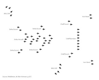 |
| Graphic. |
How did it come about, well many years ago I picked up a set of American Civil War rules and enjoyed them so much I began to write my own scenarios and drew the maps in the style used in the rules. I bought Rotring pens and a drawing board along with other drawing aides, I then produced the maps for about eight of my scenario booklets. By the end I had found Illustrator and finished the last booklet with computer generated maps, still as close to the originals as I could make them, I felt a bit sad stopping actual drawing with pens but still have the Rotring pencil which I use every day in the PO. I then met Charles Singleton through his parents who are friends of ours, Charles is a wargamer and Helion editor and an expert in the warfare of the 17th Century, he was producing a booklet on the army and battles of the Marquis of Montrose and asked if I could draw the maps. A short time later when Helion were publishing his book the director Duncan Rogers asked if I would draw a set of maps for him. I said yes and was stunned when the maps came through, they were complex and nothing like I had ever done before, but I managed it and have worked closely with Helion ever since.
 |
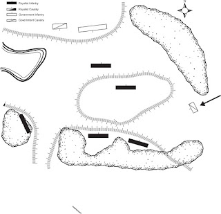
| One of my first professional maps. |


A most interesting and informative post George.
ReplyDeleteThat was quick Phil, the ink is barely dry, thanks.
DeleteOutstanding! I have often wondered about your mapping process. Thanks for the peek behind the screen.
ReplyDeleteThank you Jonathan, glad you found it interesting.
ReplyDeleteInteresting post George.
ReplyDeleteThanks David, don't usually get requests.
DeleteThank you - absolutely fascinating. Not sure how you also manage to fit in the Post Office and more painting/modelling/gaming than you can shake a hairy stick at?
ReplyDeleteI treat the maps as a day job and stop around 1700 unless I have a priority job, this gives me time for other things the rest of the evening. Glad you liked it. Oh, and it is a very quiet village PO.
DeleteThat was a fascinating insight into how you go about the mapping process. I've always loved maps, the more detailed generally the better. The older books often had fold out maps so you could follow the campaign or battle description easily, I miss that in modern books.
ReplyDeleteHope you had a good Christmas and are looking forward to an excellent New Year without any resolutions :)
Quiet Christmas and will be same for New Year, thanks. I was given some excellent British Army books on WWII operations in Normandy from the time, old type and large fold out maps, I need to get around to looking at them for scenario ideas.
Deletequite an intersting post, Ienjoyed reading it.
ReplyDeleteThanks John.
DeleteAh Rotring pens, sigh. Before I went into teaching I was a technical illustrator, I still have my precious eclipse guides, utterly useless now but I can't bare to part with them.
ReplyDeleteI had one of those bendy rulers, amazing and simple piece of kit. I have to say though that Illustrator is a superb programme which I only use a very small part of.
DeleteA very interesting post, I would like to learn Adobe at some stage to produce my own maps for my scenario books.
ReplyDeleteCheers
Matt
Cheers
Thanks. Udemy do a nice little course called Illustrator for Cartographers by Heath Robinson, basic but very useful. Youtube is also a great help. If you ever need help drop me a line. Great looking hotel by the way, must be very pleasant.
Delete